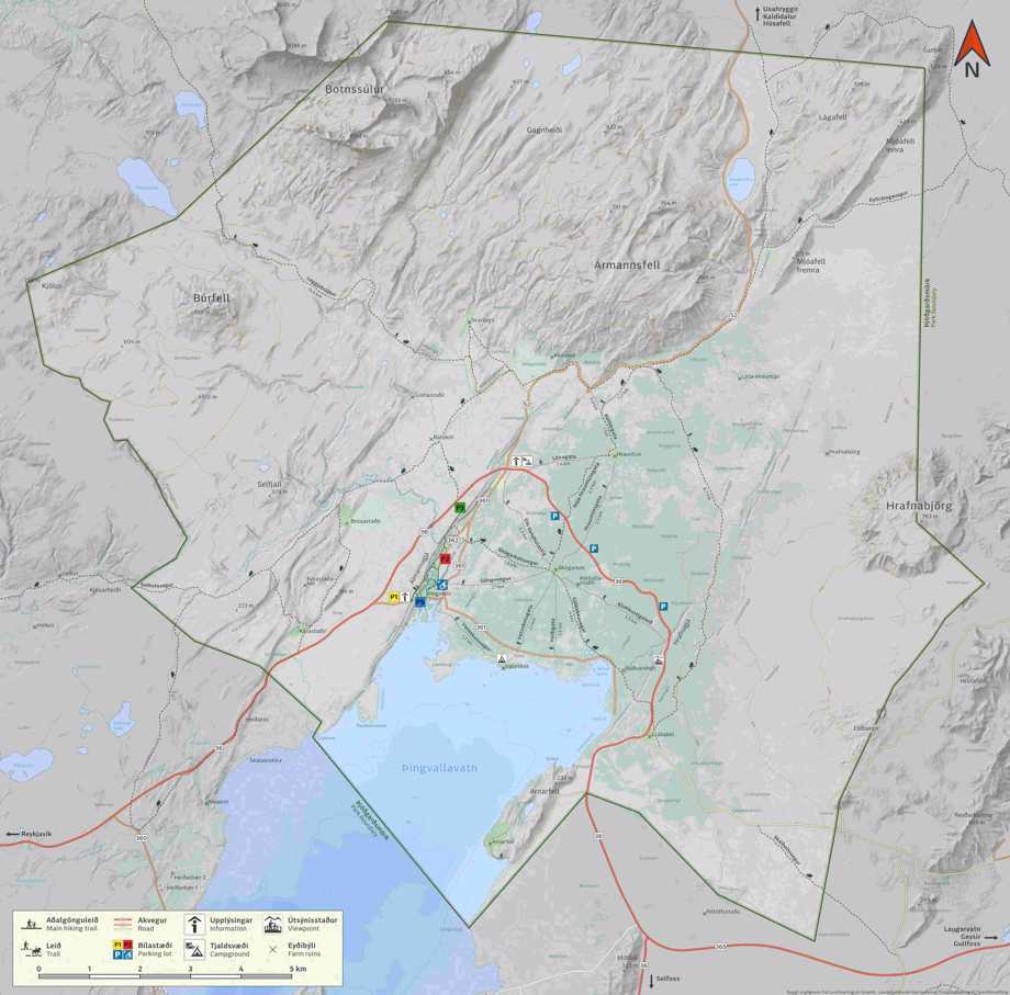
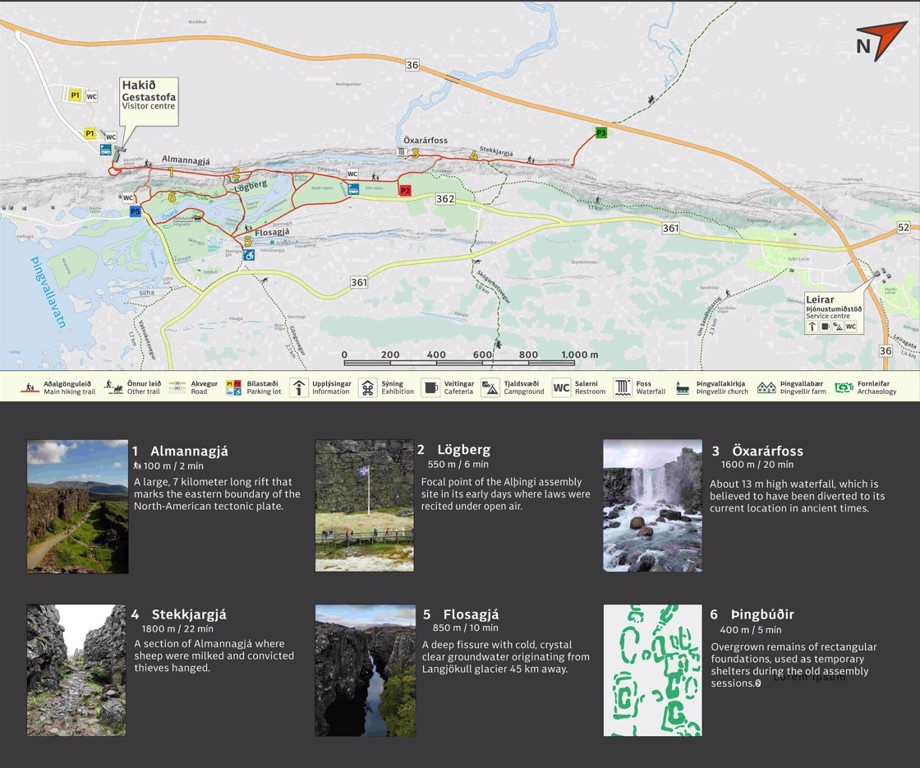
Numerous hiking trails extend over most of the national park. The trails at the assembly site are quite well signed.
Outside the ancient assembly site most of the hiking paths are associated with the abandoned farms of Hrauntún, Skógarkot and Vatnskot, remains of which can still be seen.
Map of the whole national park can be obtained here in pdf and here in jpeg.
Map of the historical assembly site can be obtained here in pdf and here in jpeg.
Horse riding is permitted along the old bridle paths of Langistígur, Skógarkotsvegur and Nýja-Hrauntúnsgata, while other trails are intended solely for walkers.

This image shows the outlines of Þingvellir national park and walking trails. Pdf version can be obtained here.
Þingvellir National Park

This map can be obtained from here in pdf.
Þingvellir Þjóðgarður